Choosing LiDAR for wind power measurement starts with the conditions at the site, not a product brochure. Wind speed and direction can vary with height, terrain, and weather. A system that performs well on an open coastal site may need different setup or checks on a forested ridge. Details matter.
LiDAR wind measurement power systems should be assessed for measurement range, data availability, environmental limits, and compatibility with the project’s measurement plan. Check which heights the instrument can cover and whether its performance has been independently validated for the intended use. Ask how it handles rain, fog, and low aerosol conditions, since these can affect data capture. A long range sounds attractive, but it is not enough by itself. Data quality, installation, and service support matter too.
Before choosing, compare the manufacturer’s specifications with the site’s actual requirements. Review maintenance needs, power and communications options, and the format of exported data. If possible, examine verification records and discuss the deployment with a qualified wind measurement specialist. Even a well-chosen instrument can disappoint when its assumptions do not match the site. That trade-off deserves a second look. This guide outlines practical criteria for comparing LiDAR systems, so readers can make a more informed choice without treating any single specification as a guarantee.
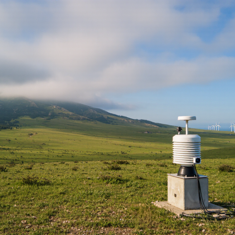
Before selecting a lidar, define the decision it must support. Is the campaign for annual energy estimation, turbine layout, power-curve verification, or checking wake effects? Each goal changes the required measurement heights, range, sampling interval, and data availability. Record the proposed hub height, terrain slope, nearby obstacles, and expected wind sectors. Small details matter. A tree line can distort low-level flow; a ridge can complicate direction and turbulence measurements.
Use maps for screening, not as a substitute for site data. The DTU and World Bank Global Wind Atlas 3.0 provides modeled wind-resource layers at approximately 250-meter resolution. That scale helps compare areas, but it cannot resolve every local obstacle or terrain feature. A map can feel reassuring. It is not the site. Compare its modeled conditions with on-site measurements and long-term reference data.
Then check whether the lidar can cover the heights your analysis needs, including the proposed rotor span, and whether its configuration suits the terrain and deployment period. IEA Wind TCP Task 32 guidance on remote sensing emphasizes documenting measurement setup and data quality. Ask how missing records, precipitation, and instrument availability will be assessed. Also confirm mounting stability, power supply, communications, and safe access. These practical checks are easy to overlook. I would revisit them after a site visit; a neat specification sheet rarely captures every field constraint.
Choosing LiDAR for wind measurement starts with the question of where the wind needs to be observed. Ground-based LiDAR sits on a stable platform and can scan several heights ahead of a proposed turbine site. It is useful for early resource assessment, especially when a tall meteorological mast is impractical. Clear sightlines matter. Terrain, rain, and nearby structures can affect data quality, so crews should check the measurement location and compare readings with a trusted reference where possible.
Nacelle-mounted LiDAR travels with the turbine and measures incoming wind near the rotor. Operators can use it to assess wind conditions during operation and support performance or control studies. But the sensor sees a changing environment: rotor wakes, nacelle flow distortion, and turbine movement may influence readings. Installation and ongoing checks matter. A convenient position does not guarantee clean data.
Floating LiDAR is designed for offshore measurements, where fixed structures can be costly or difficult to install. A buoy carries the sensor, often collecting wind profiles at multiple heights. Motion compensation and careful validation are essential, since waves can tilt or move the platform. Weather and communications may also interrupt data collection. It is tempting to treat floating systems as a simple substitute for a fixed mast; that comparison can be imperfect. Match the platform to the site, measurement period, and uncertainty the project can accept.
Start with the wind profile you need, not the longest range in a brochure. For a turbine site, check whether the instrument can sample above hub height and across the rotor’s full swept area. Local hills, trees, and access constraints may change the useful distance. Ask how range is defined, including target reflectivity, averaging time, and weather limits. Those details matter.
Compare stated uncertainty at the speeds and heights relevant to your project; a single headline figure can be misleading. Check whether validation uses an independent reference, and whether alignment and periodic checks are documented.
Then inspect data availability. Request sample files with timestamps, quality flags, missing-value codes, and delivery latency. Ask for measured uptime over a representative campaign, not just a promise of continuous operation. Rain, fog, icing, and communications outages can leave gaps, even when the sensor itself is sound. Review how gaps are reported and whether raw data remain accessible for later analysis. Perfect coverage is rare; I would rather see honest gap records than polished averages.
Choosing LiDAR starts with the measurement task, not the instrument’s range. GWEC’s Global Wind Report 2024 records 117 GW of new wind capacity installed in 2023, bringing global capacity to 1,021 GW. That expansion makes dependable site measurements increasingly important. Map the terrain, expected wind speeds, hub height, and access before choosing a deployment method. A unit beside a turbine may face blade shadows, vibration, or restricted sightlines. On exposed sites, check power supply, communications, icing, and safe servicing access. Small details matter.
Integration needs equal attention. Confirm the LiDAR’s measurement heights cover the project’s intended rotor zone, and check whether its data intervals match the site’s SCADA records. Agree on timestamps, units, file formats, and missing-data flags before installation. IEC 61400-50-2:2022 provides guidance for using ground-based remote sensing devices in wind measurement. Still, a standard cannot resolve every site-specific interface. Do not assume compatibility. Test data transfer with the actual monitoring system, not just a sample spreadsheet.
Plan validation before procurement. Define how measurements will be compared with a suitable reference, such as a calibrated meteorological mast, and document sensor placement, operating periods, and data exclusions. Compare wind speed across overlapping heights and review data availability alongside measurement differences. Set acceptance criteria in advance; otherwise, teams may explain away inconvenient results later. That is easy to overlook. It is also where confidence can weaken. Keep calibration records, maintenance notes, and processing settings together, so another analyst can reproduce the checks.
A LiDAR unit’s purchase price is only the starting point. Compare expected service life, power needs, data plans, repairs, and the cost of downtime. A remote site may require specialist travel just to inspect a connector or replace a cable. Small parts matter. Ask how calibration checks are performed and whether service can be completed locally. A lower-cost unit may become expensive if measurements stop during a critical wind campaign.
Maintenance planning should match the site’s weather and access conditions. Dust, salt, icing, and vibration can affect equipment and data quality. Review cleaning intervals, spare-part availability, technical support, and the process for checking measurement uncertainty. Certification also needs careful attention. Confirm that documented performance, calibration records, and validation methods meet the project’s technical specification and any lender or independent reviewer requirements. Requirements differ, so a certificate alone may not answer every question. A tidy spreadsheet can still miss the cost of lost data.
Tips: Request a lifecycle-cost estimate for the full measurement period. Ask for sample maintenance logs and certification documents before purchase. Check what happens when remote diagnostics fail; that detail is easy to overlook.
The cost figures below are indicative planning ranges in USD, not quotations or guaranteed market prices. Actual costs depend on configuration, site conditions, service scope, logistics, and the required measurement campaign.
| LiDAR configuration | Indicative initial budget | Lifecycle cost drivers | Typical maintenance needs | Standards and evidence to check | Most suitable use |
|---|---|---|---|---|---|
| Ground-based scanning LiDAR | Approximately $100,000–$250,000 per unit, excluding project-specific installation and service costs. | Equipment purchase; transport and site access; power and communications; periodic calibration or verification; field visits; data review; and downtime risk. | Inspect the instrument, windows, mounting, power supply, and communications on a scheduled basis. Cleaning and service frequency depend on dust, rain, icing, and other site conditions. Maintain a plan for fault alerts and data-gap review. | For wind resource measurement, check alignment with IEC 61400-50-2 and the project’s measurement plan. Review independent verification or validation evidence, uncertainty information, configuration records, and data-quality procedures. | Onshore resource assessment and complex-terrain campaigns where remote sensing can complement or reduce reliance on tall meteorological masts. |
| Nacelle-mounted LiDAR | Approximately $50,000–$150,000 per turbine, depending on system scope and integration. | Instrument and turbine integration; installation access; commissioning; maintenance access at hub height; data handling; and any required turbine downtime. | Coordinate inspections with turbine service visits where practical. Check mounting, cabling, windows, system health, and data continuity. Plan for safe access, turbine-specific integration checks, and service interruptions. | Check IEC 61400-50-3 applicability for nacelle-mounted remote sensing. For power-performance applications, also assess the applicable IEC 61400-12-1 requirements and the project’s measurement and uncertainty documentation. | Turbine-specific inflow measurement, power-performance work, and operational applications where measurements close to the rotor are required. |
| Floating LiDAR system | Approximately $250,000–$600,000 per campaign system, with marine deployment and support potentially adding substantial cost. | Buoy and sensor package; vessel mobilization; mooring and recovery; marine insurance; battery or power management; telemetry; weather-related delays; and offshore service visits. | Plan inspections around deployment and recovery, monitor buoy position and mooring status, verify power and communications, and review data for motion-related effects. Include contingency planning for severe weather and retrieval delays. | Check IEC 61400-50-4 applicability and the project’s required validation evidence. Review motion correction, uncertainty, availability, deployment records, and comparison data from an appropriate reference measurement. | Offshore wind resource campaigns where a floating measurement platform can avoid or reduce the need for a fixed offshore structure. |
| Hybrid campaign: LiDAR plus reference mast | LiDAR budget plus the additional cost of mast installation, sensors, permitting, and maintenance; total cost is highly site-specific. | Two measurement systems require coordinated installation, data synchronization, reference comparisons, inspection planning, and separate service and access budgets. | Inspect both systems, maintain traceable sensor and calibration records, and review agreement and data completeness throughout the campaign. Define responsibilities for repairs and data acceptance in advance. | Use the applicable IEC remote-sensing standard together with the relevant mast measurement standard and project requirements. Document comparison periods, uncertainty treatment, and acceptance criteria. | Projects that need stronger site-specific validation, independent comparison, or an evidence base for financing and technical review. |
Define the project goal, such as turbine layout, energy estimation, or wake assessment. Record hub height, terrain slope, obstacles, and expected wind directions. Small details matter.
No. Some modeled maps use roughly 250-meter cells, which may miss a tree line or small ridge. Use maps to compare areas, then check conditions with site measurements and long-term reference data.
It can measure several heights from a stable platform, especially when a tall mast is impractical. Check for clear sightlines, nearby structures, and terrain effects. Clear sightlines matter.
It measures incoming wind from a moving turbine. Rotor wakes, nacelle airflow, and turbine movement may affect readings. Installation and regular checks matter; a convenient position does not guarantee clean data.
A buoy can collect wind profiles where fixed structures are difficult or costly to install. Wave motion can tilt the platform, so motion compensation and validation are important. Weather and communications may interrupt records.
Check that measurements cover hub height and the rotor’s full swept area. Ask how range changes with weather, averaging time, and target reflectivity. The longest brochure figure may not be useful at your site.
Compare uncertainty at the heights and wind speeds your project needs. Ask whether readings were checked against an independent reference, and whether alignment checks are documented. One headline figure is not enough.
Request sample files showing timestamps, quality flags, missing values, and delivery delays. Ask for campaign uptime and raw-data access. Rain, fog, icing, and communication outages can leave gaps. Perfect coverage is rare.
Confirm mounting stability, power, communications, safe access, and the measurement period. A neat specification sheet may not show muddy access or an awkward power connection. I would check again after a site visit.
Choosing the right LiDAR for wind power measurement begins with clearly defining the project’s goals, the site’s terrain and weather conditions, and the heights and duration of measurements required. Ground-based, nacelle-mounted, and floating LiDAR each suit different situations: ground-based units can support site assessment, nacelle-mounted systems can monitor conditions near operating turbines, and floating systems can help gather data offshore. Compare their measurement range, accuracy, and expected data availability against the project’s needs rather than relying on a single specification.
Also consider how the system will be deployed, integrated with existing equipment, and validated against reference measurements. Review installation constraints, communications, maintenance needs, expected service life, and any applicable certification requirements. Assess total lifecycle costs, including setup, operations, servicing, and data gaps. A balanced evaluation helps ensure LiDAR wind measurement power systems provide dependable, useful measurements throughout the intended project phase.